1. Environment
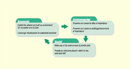
To create and maintain attractive places where people live, work and partake in recreation. To promote sustainable development by conserving the best environments, encouraging social cohesion and promoting local prosperity.
Policy 1 – DEVELOPMENT IN THE OPEN COUNTRYSIDE
1.1 Proposals for new development should be located within a settlement boundary. Proposals to develop outside of a defined settlement boundary will only be permitted in the following circumstances:
- The proposal is for small scale employment (B1, B2 or B8) use or tourism and complies with Policy 24 and or 40.
- The proposal is for the diversification of an agricultural enterprise and complies with Policy 24.
- The proposal is for an agricultural or forestry workers dwelling and is essential to the function and viability of the agricultural or forestry holding.
- The proposal would provide low cost rural housing adjacent to an existing settlement boundary where there is an identified ‘need’ in line with Policy 17.
- The proposal involves the conversion of a redundant traditional3 building to a dwelling(s) so long as it is in line with Policy 17 and PPS7.
- The proposal is for the small scale extension or alteration of an existing building. Any proposed extension in the Open Countryside should not increase the size of the original building (as at 1st July 1948 or as originally constructed if it was after this date) by more than 25%. Proposed extensions in the AONB or Green Belt must also comply with the criteria set out in Policies 2 and 3 respectively.
- The proposal is for touring caravan, tent sites, hotel, B&B or self catering tourist accommodation and complies with Policies 4A, 4B, 4C and Policy 24 and/or 40. Unless the proposal is for a touring caravan or tent site within the AONB, Green Belt, SAC, SPA, SSSI, BHS, GHS, LNI or LNR areas where these uses will not be permitted.
- Other development permitted through Local Plan Policy – including renewable energy, open space/recreation, equestrian development, woodland planting, telecommunication equipment and education/community use.
1.2 Proposals for development in an area designated as AONB, Green Belt, SAC, SPA, SSSI, BHS, GHS, LNI and LNR must conform to Policies 2-4C.
3 In this instance ‘traditional’ is defined as a building of permanent, solid and substantial construction; is constructed of natural rather than man-made or artificial materials; is of local or national architectural or historic interest and forms an integral part of the landscape.
The defined settlement boundary has been carried forward from the adopted Local Plan (January 1999). The following factors were used to draw this boundary:
- the setting of the urban area within the Landscape (topography).
- the limit to which the built form extends.
The settlement boundary also includes new allocated areas to allow these to come forward for development.
Planning Policy Statement 7: Sustainable Development in Rural Areas (PPS7) states that the quality and character of the wider countryside should be protected and, where possible, enhanced. Development in the countryside should be supported where it contributes to the rural economy, protects natural resources and conserves specific features and sites in accordance with statutory designations. Environmental designations, such as AONB, Green Belt, SAC, SPA, SSSI, BHS, GHS, LNI and LNR are identified in areas where the environment needs extra protection.
Outside of specific environmental designations PPS7 states that tools such as the landscape character assessment should provide sufficient protection to these areas without restricting acceptable, sustainable development and economic activities that underpin the vitality of rural areas. The Council have adopted Supplementary Planning Guidance (SPG) for Development in the Open Countryside (2002). All applications for development outside a settlement boundary will be considered against the material considerations contained in that SPG. In particular the Landscape Character approach must be followed for any new development. This is supported by the Joint Lancashire Structure Plan which states that development must be appropriate to the landscape character type within which the development is to be situated.
Proposals for employment in rural areas are supported through the RSS and JLSP. Policy 24 deals specifically with employment in rural areas and should be adhered to when determining planning applications for employment or farm diversification outside settlement boundaries.
New dwellings in the open countryside are not generally permitted. However, where it can be shown that it is essential for a farm or forestry worker to live at or in the immediate vicinity of their place of work an exception will be made and the construction of a dwelling permitted (refer to Annex A – PPS7). Any new dwelling should, where possible, be well related to existing buildings and have sufficient vehicle access. New dwellings in the AONB will be subject to the Council’s SPG4. New dwellings should not have a detrimental impact on the SAC, SPA, SSSI, BHS, GHS, LNI or LNR sites (Policies 4A, 4B and 4C) and buildings or areas of historic importance (Policies 9 and 10). Garden space and garaging should be kept to a minimum. Design should be consistent with the Development in the Open Countryside SPG. Permitted Development Rights may be withdrawn and any permission granted will be the subject of a condition to restrict the occupancy of the new dwelling to farm/forestry workers in the locality.
4 Borough of Pendle (2003) Forest of Bowland Area of Outstanding Natural Beauty – BoP.
The conversion of a redundant traditional building to provide one or a number of dwellings will be permitted where the development is in line with Policy 17 and PPS7. The conversion of a non-traditional building to a dwelling will not be permitted, although other alternative uses will be considered through Policies 24 and 40.
Low cost housing will be permitted in rural areas where there is a clear need. This must be proven through a valid and up-to-date housing needs assessment as detailed in Policy 17. Any proposal for affordable housing should be met in order of priority on previously developed land and buildings within a settlement boundary, followed by previously undeveloped land within a settlement boundary (Policy 17). Exception will be made in rural areas where no suitable site can be found within a settlement boundary. In this situation, the Council will permit affordable housing on small sites within or immediately adjoining an existing village. Sites must be well related to an existing village and development should be in accordance with the Landscape Character approach set out in the Council’s SPG on Development in the Open Countryside. Low cost housing sites should avoid sensitive environmental designations where possible – see Policy 17.
PPS7 identifies that tourism and leisure activities are vital to many rural economies. The tourist industry helps to sustain many rural businesses and provides a significant source of employment. Caravan parks are recognised as providing a significant proportion of all tourist accommodation. This policy allows for touring caravan and tent sites in Pendle. Static caravans will not be permitted. Touring caravan and tent sites will not be permitted within the AONB, Green Belt, SAC, SPA, SSSI, BHS, GHS, LNI or LNR areas. Similarly permission will not be granted for caravan or tent sites in areas liable to flood (see Policy 6).
Policy 2 – AREA OF OUTSTANDING NATURAL BEAUTY
2.1 The Borough Council will seek to safeguard the parts of the Forest of Bowland Area of Outstanding Natural Beauty (AONB) and its setting, located within the Borough. Planning permission will not be granted for major developments or development that would detract from the natural beauty of the Forest of Bowland AONB.
2.2 In particular, proposals for engineering works, new buildings, replacement buildings, extensions or alterations to existing buildings in the AONB should meet the following criteria:
- In respect of extensions and alterations; not to be seen in public views to dominate the existing building in terms of shape, height, materials or fenestration.
- In the case of engineering operations; not to detract from the natural beauty of the AONB.
- Not result in any loss of amenity for occupiers of neighbouring properties.
- In the case of replacement buildings; to bring about an environmental improvement and not result in a significant (i.e. no more than 25% of the volume of the original building) increase in bulk, extent or visual impact.
- In the case of a dwelling or traditional5 building; not include materials, components and finishes which are alien to the architectural traditions of the area and the architectural integrity of the building and its setting.
5 In this instance ‘traditional’ is defined as a building of permanent, solid and substantial construction; is constructed of natural rather than man-made or artificial materials; is of local or national architectural or historic interest and forms an integral part of the landscape.
The Forest of Bowland Area of Outstanding Natural Beauty (AONB) was designated in 1964. There are a number of pressures operating in the AONB area which will undermine the natural beauty upon which the designation is based. These pressures include; loss of hedgerows, unsightly buildings, intensive farming, commercial conifer afforestation and visitor pressures including a high concentration of visitors at 'honey-pot' sites such as Barley Picnic site. Some of the above pressures can be controlled through the planning system when determining applications for new development. Other policies in the Local Plan apply for example, controlling the loss of hedgerows (Policy 14) and unsightly buildings (Policy 13).
Planning Policy Statement 7 – Sustainable Development in Rural Areas (PPS7) confirms that nationally designated areas, such as National Parks and AONBs, have the highest status of protection in relation to landscape and scenic beauty. The conservation of the natural beauty within the Forest of Bowland AONB should therefore be given great weight when determining planning applications in the AONB.
PPS7 also states that the conservation of wildlife and the cultural heritage are important considerations in all these designated areas and should also be given great weight when determining planning applications in the AONB. It is also appropriate to consider economic and social issues, but environmental concerns should be at the forefront of any decision. Any application for development within the Forest of Bowland AONB should be determined against the guidance in the Council’s SPG: Forest of Bowland Area of Outstanding Natural Beauty. The SPG contains advice on the scale of development, housing, employment, farm diversification, tourism, design and landscape enhancement. A major development is 10 or more dwellings, or a residential site area of 0.5 hectare or more, or where the floor space to be built is 1,000 square metres or more, or the non-residential site area is 1.0 hectare or more.
Policy 3 – GREEN BELT
3.1 The Green Belt boundary in Pendle as identified on the proposals map will be maintained. Inappropriate development will not be permitted in the Green Belt.
3.2 Any appropriate development will only be permitted in the following circumstances:
- The proposal will not be visually detrimental to the Green Belt by reason of its siting, materials or design and will maintain the openness of the Green Belt.
- The proposal is for an exception outlined in PPG2 and is in line with Policies 1, 17, 24 and 40.
There are five purposes of including land in Green Belt; to check the unrestricted sprawl of large built up areas, to prevent neighbouring towns from merging into one another, to assist in safeguarding the countryside from encroachment, to preserve the setting and special character of historic towns and to assist in urban regeneration by encouraging the recycling of derelict and other land. To ensure the above purposes are met the JLSP identifies no strategic case for altering the general extent of the Green Belt and therefore the general extent of the Green Belt in Lancashire will be maintained. PPG2 (Green Belts) states that detailed Green Belt boundaries defined in adopted Local Plans should be altered only in exceptional circumstances.
There have been no changes to the Green Belt boundaries in Pendle.
The use of land within Green Belts will determine the effectiveness of the designation at meeting the above purposes. PPG2 states that there should be a general presumption against inappropriate development. Such development should not be approved except in very special circumstances. PPG2 provides a definition of inappropriate development and therefore clarifies what is deemed ‘appropriate’ development.
Proposed exceptions for development within the Green Belt may include the conversion of a redundant traditional building to a dwelling, a small scale extension or alteration to an existing dwelling (Policy 1), affordable housing (Policy 17), or for the replacement or re-use of an existing building for employment purposes (Policy 24), or for tourism development (Policy 40). However all exceptions must be in line with and conform to the criteria set out in the Policy.
Policy 3A – PROTECTED AREAS
3A.1 Within the areas shown on the Proposals Map as a Protected Area, no development will be permitted which would prejudice the open character of the area or its potential for long term development, during the plan period up to 2016.
It is intended that these areas should remain open during the plan period. They represent areas of choice for possible development to meet future long term requirements and to ensure the protection of the Green Belt. The future of these areas is to be re-examined through subsequent reviews of the plan. Should long term pressure for development after 2016 prove that the areas will not be required for development, consideration will be given to their inclusion within the Green Belt. For development control purposes Policy 1 – Development in the Open Countryside applies to land designated as a Protected Area.
Policy 4A – NATURAL HERITAGE – International Sites
4A.1 The Council will protect, conserve and where appropriate enhance the South Pennine Moors, Special Area for Conservation (SAC) and Special Protection Area (SPA) as shown on the proposals map.
4A.2 Development which may affect a SAC or SPA will be subject to the most rigorous examination.
4A.3 Development, not connected with (or necessary to) the management of the site for nature conservation, will not be permitted unless:
- There is no alternative solution AND;
- There are imperative reasons of over-riding public interest.
4A.4 In addition, where a site hosts a priority natural habitat and/or species, development will not be permitted unless:
- It is necessary for reasons of human health or public safety OR;
- For beneficial consequences of primary importance for nature conservation.
4A.5 The same level of protection will also be afforded to any new sites or areas which are designated by the appropriate agencies during the life time of the Plan.
The South Pennine Moors has been classified as being a Special Area for Conservation (SAC) and a Special Protection Area (SPA) under the Conservation (Natural Habitats & c.) Regulations 1994 which, formally transposes the EU directives into national law. This afforded protection issupported by English Nature and is intended to protect the habitats of threatened species of wildlife. The South Pennines Moor is protected because the habitat supports nationally important breeding birds including Merlin and Golden Plover. The area also supports a number of migratory breeding birds such as Peregrine Falcon, Lapwing, Whinchat, Common Sandpiper and Twite. The protection afforded to this site should ensure that any development proposals which are likely to affect the site, are subject to the most rigorous examination.
The SAC and SPA could be seriously damaged or even destroyed by development within, or, outside its boundary. Consequently English Nature must be consulted upon any type of development proposal within the SAC and SPA or within the defined consultation area, which is up to 2km from the boundary of the site, if the proposed development is outside the designated area. The existing South Pennine Moors adjoins the districts of Burnley, Bradford and Calderdale, so they must also be consulted.
Priority natural habitat types and species are defined in Annex F, Article 1 of Circular 06/2005: Biodiversity and Geological Conservation – Statutory Obligations and their Impact within the Planning System.
SPAs are designated under the EU Directive on the Conservation of Wild Birds: The Birds Directive. SACs are designated under the EU Directive on the Conservation of Natural Habitats and of Wild Fauna and Flora: The Habitats Directive.
Policy 4B – NATURAL HERITAGE – National Sites
4B.1 The Council will protect, conserve and where appropriate enhance all Sites of Special Scientific Interest (SSSI), as shown on the proposals map.
4B.2 Development on or likely to affect a SSSI will be subject to special scrutiny.
4B.3 Development proposals which may have an adverse effect, direct or indirect, on a SSSI will not be permitted unless:
- The reason for development clearly outweighs the nature conservation value of the site itself and the national policy which safeguards such sites.
4B.4 Where development is permitted under this exception the Council will seek the use of Planning Obligations to ensure the protection and enhancement of the site’s nature conservation interests and to ensure that there is no net loss of heritage value.
4B.5 The same level of protection will also be afforded to any new sites or areas which are designated by the appropriate agencies during the lifetime of the plan in order to ensure that as a minimum there is no net loss of heritage value.
The South Pennine Moors has been designated as a Site of Special Scientific Interest (SSSI). SSSIs are statutory sites of nature conservation and are designated through English Nature under the Wildlife and Countryside Act 1981. PPS9: Biodiversity and Geological Conservation is the national planning guidance which safeguards and protects SSSIs from adverse development.
SSSIs are designated to protect the habitats of threatened species of wildlife. This policy will ensure that any proposed development in, or within close proximity to, a SSSI will be subject to special scrutiny.
A SSSI could be seriously damaged or even destroyed by development within or outside its boundary. Therefore, English Nature must be consulted upon any type of development proposal within the SSSI or within the defined consultation area, which is up to 2km from the boundary of the site, if the proposed development is outside the designated area. The existing South Pennine Moors SSSI adjoins the districts of Burnley, Bradford and Calderdale, so they must also be consulted.
In exceptional circumstances where the reason for development clearly outweighs the nature conservation value of the site, development will be permitted. In these cases the Council will use planning obligations to ensure that mitigation and compensation measures are used to protect and enhance the site’s nature conservation interests and ensure a no net loss approach is adhered to.
Policy 4C – NATURAL HERITAGE – County and District Designated Sites
4C.1 The Council will protect, conserve and where appropriate enhance all Biological Heritage Sites (BHS), Geological Heritage Sites (GHS), sites of Local Natural Importance (LNI) and Local Nature Reserves (LNR), as defined (where applicable) by BHS Partnership, Lancashire RIGS, Lancashire Wildlife Trust and Borough of Pendle. Current sites are listed in Table 2a and shown on the Proposals Map.
4C.2 It is recognised that there may be new designations made during the life time of the Plan, therefore, the same level of protection will also be afforded to any new sites or areas designated by the appropriate agency.
4C.3 Development that would destroy or adversely affect a BHS, GHS, LNI or LNR will be subject to special control.
4C.4 In general, development proposals within a BHS, GHS, LNI or LNR site will only be permitted where it can be shown that there are exceptional economic or social benefits which clearly outweigh the extent of ecological harm.
4C.5 Where development is likely to result in loss or damage to a designated site, appropriate and adequate mitigation and compensation through planning obligations will be sought to ensure that as a minimum there is no net loss of value, and to ensure the protection and enhancement of the site’s nature conservation interests.
The 1990 White Paper ‘This Common Inheritance’ illustrated the Government’s commitment to sustainable development through reference to conserving our natural heritage. One of the main objectives of this policy is to strike a balance between development and ensuring the effective conservation of wildlife habitats, species and natural features that are essential to the social, economic and environmental well being of the Borough. One of the main aims of the Council’s Community Strategy (2003) is to create ‘A Great Environment’, by developing a Borough that makes the best use of its natural resources to create a sustainable future.
Environmental protection and conservation is not just confined to the Internationally and Nationally designated areas. Wildlife heritage is also found throughout the countryside and in urban areas. This policy seeks to protect locally acknowledged sites of nature conservation; BHS, GHS, LNI and LNR, which have not been designated as being of international or national importance.
These locally designated sites are important to the communities of Pendle and give residents the opportunity to have a direct contact with nature. These sites can provide stepping stones from one habitat to another, ensuring that the biodiversity of flora, fauna, geological and land form features as well as the survival of important species is maintained and enhanced.
The control of development in County and District designated sites is important in conserving the natural heritage of these sites. Only under exceptional economic or social circumstances will development be permitted. Any proposed development should not have a significant impact on the designation. For any development granted planning permission conditions will be imposed to prevent any damage to wildlife habitats or important physical features and planning obligations will be imposed to ensure that there is ‘no net loss’ of habitat. Consultation with the Lancashire Wildlife Trust and the Lancashire County Council Ecologist will be necessary in order to establish the acceptability of development within, or affecting, a County or District designated site.
Any development that directly or indirectly affects a site of ecological or nature heritage will be required to submit a full ecological assessment as part of the planning application. This ecological assessment will be a material consideration in any decision. Only in very exceptional circumstances – i.e. where it can be shown that there is an overriding community benefit from a proposal – will development be permitted at some expense to the environment (i.e. Policy 29, development of the proposed transport corridor). In response to this environmental assessment adequate and appropriate mitigation and compensation measures will be used to account for any loss of value to a designated site. Such measures may include a restriction of development, operations and working methods, or the relocation of all or part of the affected habitat in order to ensure that there is ‘no net loss’ of habitat. In all cases planning obligations will be used to secure the mitigation programme. Where relocation is involved the developer should liaise with the appropriate wildlife bodies to produce a management plan for the relocation work. This management plan should include a monitoring programme and a specified period of maintenance or care which should be a minimum of 5 years.
There are a number of different bodies that are responsible for designating sites for environmental protection. The BHS Partnership, endorsed by Lancashire County Council, is responsible for designating Biological Heritage Sites (BHSs). Lancashire County Council has also agreed that Regionally Important Geological and Geomorphological Sites (RIGs) in Lancashire, identified by the Lancashire RIGs Group, are equivalent to Geological Heritage Sites (GHSs). The Lancashire Wildlife Trust and the Borough of Pendle are responsible for designating Sites of Local Natural Importance (LNIs) and Local Nature Reserves (LNRs). Guidelines have been produced for designating new environmental protection sites. In particular for the designation of LNIs proposals must follow the guidelines set out in the Lancashire Wildlife Trust’s document: Guidelines for Important Wildlife Sites in Pendle (2005)6, or subsequent amendment thereof.
| Site | BHS | GHS | LNI | LNR |
|---|---|---|---|---|
| Moor Isles Clough, Greenhead Lane |

|
|||
| Spurn Clough, Greenhead Lane |
|
|||
| Round Wood Swamp, Reedley Hallows |
|
|||
| Fir Trees Brook, Higham |
|
|||
| West Close Clough, Higham |
|
|||
| Leeds and Liverpool Canal (Barden Lane to Junction 12, M65) |
|
|||
| Land at Sheffield Farm, Nelson |
|
|||
| Field at Barley Car Park |
|
|||
| Barley Road Pasture |
|
|||
| Slacks Wood, White Hough |
|
|||
| White Hough and Hugh Woods |
|
|||
| Black Moss Pasture, Roughlee |
|
|||
| Hollin Brow, Roughlee |
|
|||
| Banks Ends, Middle and Hollin Wood, Roughlee |
|
|||
| Lodge Hill Syke, Bracewell |
|
|||
| Castor Gill/Admergill Water, Blacko |
|
|||
| Burn Moor, Blacko |
|
|||
| Turf Fields, Barely |
|
|||
| Claude’s Clough/ Admergill Water, Blacko |
|
|||
| Blacko Water, Blacko |
|
|||
| Leeds & Liverpool Canal (Foulridge Wharf to the Borough Boundary) |
|
|||
| Broach Pasture, Foulridge |
|
|||
| Ghyll Lane Churchyard, Barnoldswick |
|
|||
| Bank House Flushes, Wycoller |
|
|||
| Lomeshaye Marsh |
|
|
||
| Bleara Moor |
|
|||
| Kelbrook Moor and Woods, Roger Moor |
|
|||
| Foulridge Reservoirs |
|
|||
| Gilford Clough, Trawden |
|
|||
| Turnholes Flushes and Grassland, Wycoller |
|
|||
| Turnholes Clough, Trawden |
|
|||
| Coldwell Reservoirs |
|
|||
| Catlow Valley |
|
|||
| Old Laund Clough |
|
|||
| Raven’s Clough Wood |
|
|||
| Whitemoor and Weets Hill |
|
|||
| Heald Wood, Reedley Hallows |
|
|||
| Barden Lane Fields, Reedley Hallows |
|
|||
| Black Moss Reservoirs |
|
|||
| Whitemoor Reservoir |
|
|||
| The Crank, Wycolller |
|
|||
| Harden Clough, Kelbrook |
|
|||
| The Former Railway Line (Colne to Earby) |
|
|||
| Pendle Hill |
|
|||
| Land adjacent Coldwell Resveroirs |
|
|||
| Leeds & Liverpool Canal (Barrowford Locks to Foulridge Tunnel) |
|
|||
| Sandhole Clough, Foulridge |
|
|||
| Barrowford Locks Hills and Hollows |
|
|||
| Wanless Bridge Triangle |
|
|||
| Sough Pasture, Sough |
|
|||
| Birch Hall Lane Pasture |
|
|||
| Stanridge and Three Acre Cloughs |
|
|||
| Windle Field |
|
|||
| Wycoller Beck |
|
|||
| Emmot House Grassland |
|
|||
| Higher Old Laund Pasture |
|
|||
| The Railway Sidings, Knotts Lane, Colne |
|
|||
| Field numbers 750, 461, 462 at Gib Hill, Nelson |
|
|||
| Salterforth Railway Cutting |
|
|
||
| Turn Hill |
|
|||
| Castercliffe |
|
|||
| Ball Grove Lodge, Colne |
|
|||
| Walverden Reservoir |
|
|||
| Greenfield, Colne |
|
|||
| Corn Close/Bent Moor, Boulsworth |
|
|||
| Flake Hill Moor, Trawden |
|
|||
| Antley Gate, Boulsworth |
|
|||
| Leeds & Liverpool Canal (Barrowford Locks to Junction 12, M65) |
|
|||
| Upper Ball Grove, Colne |
|
|||
| Greenfields, Colne |
|
|||
| Alkincoats Woodland, Colne |
|
6 Lancashire Wildlife Trust (2005) Guidelines for Important Wildlife Sites in Pendle. LWT
Policy 4D – NATURAL HERITAGE – Wildlife Corridors, Species Protection and Biodiversity
4D.1 The Council will protect Wildlife Corridors and encourage the reestablishment of habitats and species populations to help maintain and enhance biodiversity.
4D.2 Proposals for development should not significantly affect the function of Wildlife Corridors to maintain the migration and dispersal of wildlife. Where development is permitted, the developer will be expected to enhance existing Wildlife Corridors. Conditions and Planning Obligations may be used to ensure that the necessary compensatory measures are provided.
4D.3 Development proposals that would adversely impact or harm, directly or indirectly, legally protected species will not be permitted, unless shown to meet the requirements of The Conservation (Natural Habitats, &c.) Regulations 1994.
4D.4 Development proposals should ensure that biodiversity levels are maintained and where appropriate enhanced. Proposals which would adversely affect the levels of biodiversity on the development site will not be permitted unless:
- Adequate provision is made through conditions or Planning Obligations to protect, maintain and enhance existing biodiversity or replace, manage and enhance any loss of biodiversity caused by the development.
The Regional Spatial Strategy for the North West seeks to restore and reestablish wildlife habitats and ensure the appropriate management of Wildlife Corridors. Railway lines, roadside verges, hedgerows, walls and watercourses such as canals, rivers and Sustainable Urban Drainage Systems (SuDS) can help to form vital ecological corridors and networks. These allow species to migrate and disperse and this, in turn, helps to increase the overall biodiversity of an area. These can be classified as wildlife corridors.
One of the key priorities of Policy ER5 of the RSS is to reverse habitat fragmentation by protecting and enhancing wildlife corridors which provide ecological linkages. Developments should therefore take account of these wildlife corridors, enhance them and where appropriate extend them.
Site specific nature conservation designations do not always cover legally protected species (i.e. those protected under the Conservation (Natural Habitats, &c.) Regulations 1994) as there may be many undesignated sites which provide habitats for protected species. It is therefore important that development does not harm the habitats of legally protected species or the species themselves. English Nature must be consulted upon where development proposals may impact on a protected species. In the case of European protected species such as Great Crested Newts or Bats, proposals must comply with the tests set out in the Conservation (Natural Habitats, &c.) Regulations 1994.
Provision should be made to avoid or reduce the disturbance to these species. Measures may include the use of carefully designed schemes, working methods and restrictions on development operations. In some circumstances it may be necessary to relocate the species to a replacement habitat. Planning conditions and/or obligations will be used to ensure that the total ecological resource level is maintained or enhanced by appropriate compensation measures.
The loss of wildlife in terms of variety and quantity of species and habitats is of great concern. Consideration of the targets set out in the Biodiversity Action Plan for Lancashire and the UK should be made when determining planning applications likely to affect the level of biodiversity.
It is not just important to halt the loss of biodiversity but also to enhance it. Therefore proposals which include biodiversity enhancement within the development scheme will be encouraged. Enhancement schemes may include the increased use of locally native flora within landscaped areas of a development, the creation of new wildlife habitats such as ponds, or the provision of nest boxes. However in cases where the development would result in the unavoidable reduction in the biodiversity level, planning conditions and obligations will be used to ensure that appropriate compensation measures are provided.
An ecological assessment will be required for any development proposal affecting sites defined within Policy 4D. The assessment should also detail the appropriate mitigation and compensation measures to account for any loss to these sites.
Policy 5 – RENEWABLE ENERGY SOURCES
5.1 The Council are committed to providing a renewable energy supply for Pendle and will support any new energy sources arising in the future provided they are compatible with all other Local Plan policies. It is important to maintain a balance between the need to develop clean, green energy and the need to conserve the landscape and natural and man-made heritage. The Council will apply the following criteria to the following renewable energy proposals:
5.2 Solar Energy – Solar photovoltaic (PV) panels will be encouraged on existing buildings (with the exception of Listed Buildings) and proposed buildings as long as they are not visually intrusive.
5.3 Wind Turbines – Individual or groups of turbines will be permitted outside of the AONB, SAC, SPA, SSSI, Green Belt, Biological Heritage Sites, Geological Heritage Sites, sites of Local Natural Importance or Local Nature Reserves. Turbine developments adjacent to designated areas should be assessed for their visibility from the designated area and the precise character and nature of the local countryside. Within designated areas, individual or groups of turbines will be permitted provided that there is no serious environmental detriment and they respect the local countryside’s character. Large scale wind farms will be resisted and wind turbine developments will be required to provide benefit to the local community subject to them meeting Circular 05/2005 (Planning Obligations) tests. Any development must be in line with Policies 2, 3, 4A, 4B, 4C and 4D.
5.4 Power stations fuelled by organic matter – power stations will be permitted outside of the AONB, SAC, SPA, SSSI, Green Belt, Biological Heritage Sites, Geological Heritage Sites, sites of Local Natural Importance or Local Nature Reserves so long as they provide energy to the local area and will not be detrimental to the local environment. Appropriate landscaping should be introduced to screen new power stations.
5.5 All forms of renewable energy development must avoid the vicinity of Scheduled Monuments. Listed Buildings and their setting should also be avoided unless appropriate design solutions can be found. Any application within or affecting the setting of any feature of the historic environment must comply with Policies 9, 10 and 11.
5.6 All redundant renewable energy structures or equipment must be removed within 1 year.
5.7 Within designated areas (AONB, SAC, SPA, SSSI, Green Belt, Biological Heritage Sites, Geological Heritage Sites, Sites of Local Natural Importance or Local Nature Reserves) planning permission for renewable energy developments will only be granted where it can be demonstrated that the objectives of designation of the area will not be compromised by the development, and any significant adverse effects on the qualities for which the area has been designated are clearly outweighed by the environmental, social and economic benefits. Outside designated areas renewable energy developments should not cause serious landscape or environmental harm.
The sustainable use of renewable resources and the conservation of nonrenewable sources helps conserve the environment and reduce pollution. The main advantage is a reduction in Carbon Dioxide emissions, produced principally from the burning of fossil fuels. Additional benefits include the creation of new jobs and opportunities for rural diversification. This policy supports the implementation of renewable energy projects, including solar power, wind and organic matter (e.g. wood chippings and natural waste) in Pendle. In addition, the policy supports any new sources of renewable energy that may be developed over the period of the Plan that may assist in contributing to energy targets whilst remaining compatible with all other Local Plan policies. The policy does however recognise the importance of balancing the needs of renewable energy developments with conservation of the landscape and heritage of the Borough. As per the Joint Lancashire Structure Plan criteria, all applications should demonstrate the following; the impact on the surrounding natural and man-made built environment; the minimising of material harm to acceptable levels; the contribution to targets and green house gas emissions; the wider benefits of the proposed scheme.
The Government has set a target requiring 10% of the UK’s energy to be provided by renewable sources by 2010. The Northwest Climate Group produced an action plan for the North West7. This seeks to provide 10 large wind turbines and 25 small scale turbines across the North West as part of the commitment to meeting the national target for renewable energy by 2010. The Regional Spatial Strategy for the Northwest seeks a positive approach to renewable energy provision. PPS22 (Renewable Energy) states that the wider environmental and economic benefits of all proposals for renewable energy projects, whatever their scale, are material considerations that should be given significant weight in determining whether proposals should be granted planning permission. The Government’s policies for developing renewable energy sources must be weighed carefully with its continuing commitment to policies for protecting the environment. It will always be a material consideration that a particular proposal should demonstrate minimum harm to the countryside, as identified in the Council’s SPG, Development in the Open Countryside (2002). In Pendle energy companies have demonstrated that the Borough is unable to accommodate large scale wind farms due to both the geographical and environmental factors found within the area. For this reason, the Council will resist any proposals for large scale wind farms. However, this policy supports those applications that are possible without serious environmental detriment and that will contribute to Lancashire County Council’s targets for onshore renewable energy electrical generation (95MW by 2007, 116MW by 2010).
7 Sustainability Northwest (2001) From Power to Prosperity: advancing renewable energy in
northwest England. SN
Development projects will be confined to those that supply some community benefit to the local area via contributions to a local community fund in cases where the tests of Circular 05/2005 are met. This Policy also seeks to control new development in areas of important environmental designation, namely AONB, SAC, SPA, SSSI, Green Belt, Biological Heritage Sites, Geological Heritage Sites, sites of Local Natural Importance or Local Nature Reserves. These are areas where the structures or equipment involved in producing renewable sources of energy are likely to cause most environmental harm (with the exception of solar power). The Council’s Supplementary Planning Guidance (Development in the Open Countryside) contains further advice. Sensitivity must not only be applied to those applications within designated areas but also those adjacent to designated areas. Wind turbines in particular, when adjacent to designated areas, may affect people’s enjoyment of the objectives of the designated area. Therefore an assessment should be made regarding visibility from the designated area and the precise character of the countryside.
Small scale and building related renewables including low or zero energy schemes also provide great potential for increasing energy efficiency and reducing reliance on non-renewable energy forms. Such developments should be encouraged and should be a key consideration in the determination of planning applications.
All redundant equipment and structures should be removed within 1 year. Planning Permissions will be conditioned to this effect. Tougher decommissioning targets for wind turbines are set in the Council’s SPG.
Policy 6 – DEVELOPMENT AND FLOOD RISK
6.1 Development will not be permitted where it would:
- Be at risk of flooding and no appropriate flood alleviation measures exist or will be provided by the developer, AND/OR
- Increase the risk of flooding elsewhere by reducing the capacity of the floodplain, installing a culvert, or increasing the flow of water into the floodplain, AND/OR
- Harm existing flood defences or have an impact on proposed flood defence schemes, AND/OR
- Restrict adequate access to the river and/or existing flood defences for routine maintenance and improvement.
6.2 Appropriate flood alleviation measures may include the use of Sustainable Urban Drainage Systems (SuDS). However any measure would have to first be approved by the Council and the Environment Agency.
6.3 Proposals for development within areas liable to flood8 must be accompanied by an appropriate9 Flood Risk Assessment where the development is perceived10 to be at risk of flooding or the development is likely to increase the risk of flooding elsewhere.
8 See Supplementary Planning Guidance for up-to-date indicative floodplain in Pendle. See Appendix 3 to find out how to obtain a copy.
9 PPG25 – Appendix F outlines the issues to be covered in a Flood Risk Assessment
10 The views of the Environment Agency will be sought on any development proposal within an indicative floodplain.
The Government’s policy on flood risk is to reduce the risks to people and the developed and natural environment. Experience over recent years suggests that both the frequency and scale of flooding may be increasing. PPG25 (Development and Flood Risk) attributes this to variations in rainfall and increased development in areas at risk. In addition, climate change is expected to increase the risk of both coastal and river flooding as a result of sea-level rise.
The Environment Agency has prepared maps showing areas of flood risk. These maps identify Flood Zones, and classify areas as Flood Zone 3 (high risk), Flood Zone 2 (low to medium risk) or Flood Zone 1 (little or no risk), and in accordance with Table 1 of PPG25, which identifies the types of development appropriate to each zone. The Council has produced Supplementary Planning Guidance11 for Development and Flood Risk that was adopted in 2004 and which it regularly updates. It contains maps prepared by the Environment Agency that identify Flood Zones and advice on flooding issues. The Environment Agency has the lead role in relation to planning applications and flood risk. Any application for new buildings proposed in the floodplain and where the Environment Agency perceive there to be a risk, should be accompanied by a Flood Risk Assessment. This should evaluate the potential risk, identify increases in flooding elsewhere as a result of the proposed development and should detail any remedial actions. This is in line with the precautionary approach detailed in PPG25. The Council will not validate planning applications for development in flood risk areas that are not accompanied by a Flood Risk Assessment.
11 Borough of Pendle (2004) Development and Flood Risk. BoP See Appendix 3 to find out how to obtain a copy.
PPG25 requires local planning authorities to adopt a risk-based approach to proposals for development in or affecting flood risk areas. The aim of this policy is to limit development in areas at risk of flooding, unless adequate alleviation measures can be implemented by the developer. The Council’s SPG gives details on the use of Sustainable Urban Drainage Systems (SuDS) as a flood alleviation measure. This guidance should be used in the determination of planning applications. Any alleviation measures must not compromise alleviation measures or increase flood risk further downstream (including cross-district). The Policy also attempts to avoid increases in surface run-off in excess of the manageable capacity of a floodplain. In addition the Policy seeks to avoid development which would impact on existing or proposed flood alleviation measures, prevent access to rivers for routine maintenance and improvement, or introduce culverts that could become blocked and create a flood risk either to the development itself or elsewhere.
Policy 7 – WATER RESOURCE PROTECTION
7.1 Development proposals that have an adverse impact upon the Borough’s groundwater resources with regard to quantity and quality will not be permitted.
7.2 Proposals that will detrimentally affect the Borough’s surface water bodies and courses will not be granted, unless there are overriding economic or social benefits and the developer introduces mitigation measures to avoid, or sufficiently minimise damage.
7.3 Development proposals that include the construction of new culverts will only be permitted if the culvert is essential for either access purposes or reasons of public safety.
Groundwater resources are essential to the Borough’s public water supply, rivers and streams. Its protection is fundamental in contributing towards a sustainable environment, and the Community Strategy’s aim of improved health for the residents of Pendle.
As well as providing a source of water supply, groundwater resources are equally important for maintaining surface waters through springs and rivers, and supporting wetlands and their ecosystems. Consequently, any reduction in the quality and quantity of groundwater will also detrimentally impact on the Borough’s surface water provision. The groundwater resources of Pendle are coming under increased pressure. Development of housing and industry can influence natural run off patterns and in effect prevent the groundwater supply from replenishing. Pollution from industry and farm effluents can effect quality.
Through close liaison with the Environment Agency and Water Companies, the Council will assist in water resource protection by resisting development that will detrimentally affect groundwater supply.
Surface water resources, such as the Leeds – Liverpool Canal and the Foulridge reservoirs, offer important community value through recreation and tourism, as well as providing sanctuary for wildlife. In addition to creating a flood risk, the culverting of open watercourses reduces groundwater recharge and increases the difficulty in detecting the origins of pollution and in monitoring the quality of surface waters. Culverting also results in the loss of wildlife habitats.
It is important that development has regard to and does not harm such areas. The views of the Environment Agency will be sought on any proposal affecting a surface water resource. Where conflict with development is unavoidable, a design statement will be required of the developer to illustrate how the proposal will take account of the resource and ensure there is no net loss to the community it serves. Contamination of ground and surface water is dealt with in Policy 8.
Policy 8 – CONTAMINATION AND POLLUTION
8.1 Proposals for industrial development or those developments where odours, noise, or vibration are likely, should be accompanied by a statement illustrating the levels of potential pollution and any remedial action to be undertaken. A statement will be required for applications involving outdoor lighting. Development will be permitted where:
- There is likely to be no harmful pollution or contamination
OR
- Any proposed remedial action is sufficient to reduce the risk of pollution
AND
- The application does not involve the storage of hazardous substances where such storage would pose a potential risk to nearby residents or visitors.
8.2 IN ADDITION planning permission will only be granted where the Council are satisfied that the proposed development would not:
- Expose the occupiers of the development and neighbouring land uses to unacceptable risk
- Threaten the structural integrity of any existing or proposed building on or adjoining the site
- Lead to the contamination of any watercourse, water body, or groundwater
- Cause the contamination of adjoining land or allow such contamination to continue.
8.3 Developers proposing to develop any brownfield site or land within 250 metres of a landfill site must conduct an investigation and assessment to identify the types, nature and extent of any contamination, including the potential risk from migrating landfill gas, potentially affecting the application site and environs. A comprehensive remediation scheme should be included with the application where appropriate. Only where the Council’s Environmental Health Department and associated pollution control authorities are satisfied that the risk from pollution is adequately controlled will permission be granted.
Central Government attach great importance to the control and minimisation of pollution. Through the White Paper (1990)12 they have made clear their commitment to sustainable development, by minimising the risk to human health and the environment through the prevention of pollution and contamination.
12 Department of Environment (1990) This Common Inheritance – White Paper. DoE.
The purpose of this policy is to prevent the release of harmful pollutants into the atmosphere, ground or controlled waters through leakage and drainage from, and disturbance of, contaminated land. The policy also seeks to control nuisances such as noise, light and odour. Any developer proposing potentially contaminating development will be required to supply a statement detailing possible pollution and remedial action. For the purposes of this policy Industrial includes B1 (b), B1 (c), B2 and B8. Other developments likely to cause odours, noise, light or vibration include; A3 (restaurants/cafes), A4 (pubs/bars), A5 (hot food take-aways) uses, tattoo studios, pet shops, kennel or catteries. It is particularly important to control light pollution in the open countryside and any application involving lighting in the open countryside should be accompanied by a statement in line with the Council’s SPG (Development in the Open Countryside).
The Council’s Environmental Health Department and the pollution control authorities will be consulted upon all potentially polluting development proposals. Proposals will be assessed against the possible impact on surrounding land use, including the effects on health, the natural environment and controlled surface and groundwater’s or general amenity, and the proximity of sensitive land uses, including schools, housing and environmental designations, to any potential pollutants. Any proposal which is shown to pollute or potentially pollute the environment will be resisted. Remedial actions to control or reduce pollution can successfully render a potentially polluting use suitable. All remedial actions should be identified in the supporting statement.
In some cases planning permission may be granted where pollution can be kept to a minimum and the social and economic benefits outweigh the environmental concerns. Many developments can be controlled through the use of conditions. For example the introduction of floodlighting to existing sports facilities in the Green Belt may be of benefit to the community, but at the same time will increase levels of light and noise pollution. Conditions may be imposed to limit the type of pollutant, in this case a restriction on evening opening times and landscaping could be used to deter the pollutant impacts.
PPS23 (Planning and Pollution Control) stresses that development plans should steer development onto appropriate previously developed land, some of which may be affected by contamination. Likewise the RSS seeks to tackle derelict and contaminated land. Such recycling can also provide an opportunity to deal with the threats to health or the environment posed by contamination. Any proposal for development on a brownfield site or on or in close proximity to a landfill site must be accompanied by a full site investigation into the potential risk from land contamination and migrating landfill gases. A site investigation must be carried out by an appropriately qualified geotechnical professional. A comprehensive remediation scheme, including a timetable and future monitoring must be included where appropriate. Remedial measures agreed as part of any planning permission should be implemented and completed in accordance with the agreed scheme. In applying this Policy, the Council will have regard to advice given by the Environment Agency and other relevant bodies.
Policy 9 – BUILDINGS OF SPECIAL ARCHITECTURAL OR HISTORIC INTEREST
9.1 The Borough Council will seek to preserve statutory Listed Buildings and conserve buildings of historic or architectural importance. These may be identified on the statutory list of buildings13, on the Lancashire Sites and Monuments Record, or on a local list. For Listed Buildings the Council will:
- Not grant consent for demolition other than in exceptional circumstances where the Council is satisfied that every possible effort has been made to retain the building, continue its present use or find a suitable new use;
- Safeguard the setting of Listed Buildings through the control of new development (including changes of use) in the vicinity and, where appropriate, by the preservation of trees and other important features;
- Ensure proposed change of use, alterations and extensions have no adverse effects on a Listed Building’s special interest, character and appearance and that loss of historic features and fabric is minimised. A record of all irreversible alterations must be made and placed in an appropriate archive;
- Refuse consent for the use of modern materials or features such as cement mortars or renders, artificial stone and slate, upvc or other plastics, aluminium or stained timber windows, doors or watergoods, burglar alarms, solar panels, rooflights and dormers, where these are considered to be inappropriate and likely to harm the historic or architectural character of the building or structure. The Council will require that schemes of repair and conservation use traditional methods and materials, unless it can be demonstrated that another approach is appropriate.
9.2 For non-listed buildings of historic or architectural importance the same general approach will be used, but the controls will be applied at a level commensurate with the importance of the building in question.
13 Prepared by the Department of Culture, Media and Sport (DCMS).
Buildings or monuments of historic, architectural or cultural importance can be listed. Statutory Listed Buildings are subject to stringent planning control. Listed Building consent must be obtained before any alteration can be made which would affect a statutory Listed Building’s special interest. As well as the statutory list (prepared by DCMS), Lancashire County Council maintain a record of all sites and monuments in Lancashire. The JLSP supports designations of both national and local importance. The Council will recommend the statutory listing of buildings where special historic or architectural interest is believed to exist. In addition, the Council will compile a local list of buildings of historic or architectural importance in consultation with local people.
Every effort will be made to preserve statutory Listed Buildings. PPG15 (Planning and the Historic Environment) states that applications for demolition of any Listed Building should be carefully scrutinised and suggests that there will be very few occasions where demolition is considered unavoidable. In very exceptional circumstances where permission is granted for the demolition of a statutory Listed Building, the Council will firstly have to approve detailed plans for the redevelopment of the site and the letting contract for development, submitted by the developer. It will also be necessary for the developer to provide means for the recording and storage of features and materials from Listed Buildings where demolition consent is granted.
Generally the best way of securing the upkeep of buildings is to keep them in active use. However, change of use and subsequent alterations or extensions can be damaging to a Listed Building. PPG15 states that achieving a balance between the special interest of a Listed Building and proposals for alterations or extensions is demanding and should always be based on specialist expertise. The Council will consult their Conservation Officer on any application for proposed change of use or alteration to a Listed Building or its setting. Applications will be refused where there is insufficient detail to enable the determination of that application. Further guidance is contained within the Built Heritage Strategy14 ‘Laying Foundations’.
14 Borough of Pendle (1997) Built Heritage Strategy: Laying Foundations. BoP
Where proposals affect any non-listed building of architectural or historic importance, the Council will seek to control development which significantly affects the structure or its setting, and the approach will be similar to that set out for statutorily Listed Buildings. Controls will, however, generally be less stringently applied and will be at a level commensurate with the importance of the building.
It is important for developers to be aware that buried archaeological remains often survive under and around Listed and non-Listed Buildings. The impact of development in these areas should be assessed against criteria set out in Policy 11.
Policy 10 – AREAS OF SPECIAL ARCHITECTURAL OR HISTORIC INTEREST
10.1 The Borough Council will seek to conserve areas of identified historic or architectural interest and their setting. These will be designated as Conservation Areas or Historic Parks.
The Council will:
- seek to ensure a particularly high design standard that preserves or enhances the character and appearance of the area and its setting. In addition to general design criteria, any development proposals must have regard to the following matters:
- the retention of historic buildings and materials, groups of buildings, building lines, vistas, street patterns and floor surfaces;
- the impact on open spaces and trees;
- the retention of architectural features such as boundary walls, shop fronts and other elements which contribute to the character of the area;
- the impact on the wider townscape and roofscape;
- the effect on land-use mix, activities, noise levels and sense of place
- only grant consent for demolition (where permission is required) where a building is not of townscape, architectural or historic interest, and where an acceptable scheme of replacement or after-use for the site can be reasonably guaranteed.
- designate new conservation areas where there is considered to be special architectural or historic interest, the character or appearance of which it is desirable to preserve or enhance.
- seek to protect and enhance any parks, gardens and cemeteries of historic interest, and their setting, particularly those identified on the English Heritage Register of Parks and Gardens of Special Historic Interest
Conservation Areas are areas of special architectural or historic importance that have special character and/or appearance which it is desirable to preserve or enhance. Conservation Areas can be designated by the Local Authority with the involvement of local people. It is the intention of the Council to conserve the special features of existing Conservation Areas and to designate new Conservation Areas where appropriate. In exercising Conservation Area controls, local planning authorities are required to pay special attention to the desirability of preserving or enhancing the character or appearance of the area. The general presumption should be in favour of retaining buildings which make a positive contribution to the character or appearance of a Conservation Area. The Council have prepared SPG for a number of the Borough’s Conservation Areas. Article 4 directions may be used to remove permitted development rights within Conservation Areas. This would then help to further control development which may occur in these areas.
PPG15: Planning and the Historic Environment considers the setting of a Conservation Area to be important in preserving or enhancing the area. PPG15 states that the desirability of preserving or enhancing a Conservation Area should be a material consideration when determining development proposals which are outside of a Conservation Area but would affect its setting, or view into or out of the area.
The demolition of buildings within a Conservation Area is strictly controlled. PPG15 contains guidance on proposals to demolish such buildings stating that proposals should be assessed against the same criteria as for Listed Buildings.
PPG15 states that local planning authorities should protect registered parks and gardens in determining planning applications. The Council will seek to protect and enhance any parks, gardens and cemeteries of historic interest and their setting. The most important of these may be included on the English Heritage Register of Parks and Gardens of Special Historic Interest.
It is important for developers to be aware that buried archaeological remains often survive in areas of architectural or historic interest. The impact of development in these areas should be assessed against criteria set out in Policy 11.
Policy 11 – ARCHAEOLOGY
11.1 Nationally important monuments, including Scheduled Monuments and other sites of national importance and their settings will be preserved. Proposals which fail to preserve those monuments in situ will not be permitted.
11.2 Development proposals that affect sites that are neither Scheduled Monuments nor otherwise of national importance will be dealt with on their merits.
11.3 Where development proposals could affect a site or its setting, the applicant may be required to carry out an archaeological assessment or undertake a site evaluation before any planning application is determined.
This must:
- Identify any archaeological remains within and/or adjacent to the application site, AND
- Assess the likely impact of the proposed development on any identified remains, AND
- Demonstrate the means of reducing any identified impact in order to conserve the remains.
11.4 Only development which would conserve any identified archaeological remains will be permitted. Where development is permitted, recording in advance or during development may be required.
The Government describe archaeological remains as finite and non-renewable resources, in many cases fragile and vulnerable to damage and destruction. Archaeological remains contain irreplaceable information about our past and are valuable for their own sake and for their role in education, leisure and tourism. Demands for a modern society mean that it is not always possible to preserve all archaeological remains. A balance must be sought between preservation of archaeology and modern development. This policy seeks to preserve in situ those archaeological remains of national importance, whether Scheduled Monuments (Ancient Monuments and Archaeological Areas Act 1979) or not. In January 2005 there were 11 Scheduled Monuments in Pendle Borough. These are identified on the proposals map. More sites may be added to the schedule as research is undertaken and sites identified.
For the purpose of this policy, preservation means to prevent any alteration which would cause damage to the monument or impact on the setting of visible remains. Development which would harm a nationally important monument, whether scheduled or not, will not be permitted. Works to Scheduled Monuments or which would affect their settings almost always require Scheduled Monument Consent from the Department of Culture, Media and Sport and early consultation with their advisors, English Heritage, is recommended.
As well as Scheduled Monuments there are many other archaeological and historic sites of interest in Pendle Borough. Many of these are included in the Lancashire Sites and Monuments Record, which is maintained by Lancashire County Council Archaeological Services. Sites and monuments contained on this Record can be of national, county, regional or local importance and may be buried or standing remains, findspots or landscape features.
Development proposals that affect sites that are neither Scheduled Monuments nor otherwise of national importance will be dealt with on their merits. Where development proposals could affect a site or its setting the developer may be required to carry out an archaeological assessment or undertake a site evaluation before any planning application is determined. The Government’s attitude to archaeological sites is set out in PPG16, where there is a presumption in favour of preservation of Scheduled Monuments. Other archaeological sites are to be dealt with on their merits, but it is acknowledged that preservation by record is only a second-best option. The Council will seek advice from the Lancashire County Council Archaeological Service when making decisions on the need for an archaeological assessment or evaluation and the suitability of a proposed development. Only development which seeks to conserve any archaeological remains will be permitted. Where development is permitted recording work may be necessary before or during development. This will be sought through a planning condition or other legal agreement.
Policy 12 – MAINTAINING SETTLEMENT CHARACTER
12.1 The development of land which contributes to the openness, character and local amenity of a settlement will not be permitted, unless the development proposal is for the enhancement or improvement of existing on site facilities. Sites are identified on the proposals map as:
- Chapelfields, Kelbrook
- Windermere Avenue, Colne
- Dean Street, Trawden
- Applegarth, Barnoldswick
- Higham Hall Road, Higham
- Halifax Road, Brierfield
- Back Lane, Trawden
Informal open spaces within defined settlement boundaries often play an essential role in the character of that particular settlement, with regard to setting and local amenity. It is important that these areas are identified and development is resisted, in order to conserve settlement character. However, enhancement and improvement to the existing on site facilities will be permitted provided the proposal maintains the openness and character of the site. For example, the creation of formal open space is encouraged through Policy 34.
The sites identified above are all allocated on the proposals map. Smaller sites can offer a similar benefit to local amenity, and so contribute toward settlement character. These sites have been identified through the Open Space Audit (2003) appearing as Amenity Open Space, and will afford the same protection. Exceptions to development on these smaller sites will only be made through Policy 33.
Policy 13 – QUALITY AND DESIGN OF NEW DEVELOPMENT
13.1 The Council will protect and enhance the heritage and character of the Borough and quality of life for its residents by encouraging high standards of quality and design in new development. All development proposals should comply with the following:
- Siting and design should be in scale and harmony with the surroundings, innovative where possible, and contribute towards the character of an area. Housing densities should reflect those in Policy 20.
- Natural Stone and slate appropriate to the vicinity in respect of colour and type should be used on Listed Buildings. This will also apply to Conservation Areas unless there is a predominance of artificial materials in the vicinity. In other locations artificial stone and slate appropriate in colour to the immediate vicinity will be permitted.
- Metal frame buildings, including roofing design, will be of muted hues and darker colours.
- Existing trees and hedgerows to be protected in line with Policy 14 and appropriate landscaping to be introduced in line with Policy 16.
- Sustainable drainage systems shall be incorporated unless evidence is produced to justify why such schemes are not appropriate, in which case an acceptable alternative must be incorporated.
- The development shall demonstrate that it incorporates satisfactory standards of security to prevent crime both within the development site and in the surrounding area.
13.2 Shop front security proposals should conform to guidance contained within the ‘Shop Front Security’ supplementary leaflet15.
13.3 Proposed advertisements must not impinge on residential amenity or highway safety.
13.4 Proposals which promote sustainable construction techniques, including energy efficiency and the use of renewable energy will be encouraged, in line with Policy 5.
15 See appendix 3 to find out how to obtain a copy.
Through this policy the Council aims to protect and enhance the heritage and character of the Borough, by encouraging high standards of design in new and existing development. This is important in realising the Council’s Community Strategy objectives which seek to ensure that the residents of Pendle enjoy the best possible quality of life, and that Pendle is an attractive place where people choose to live, work and visit. Quality in new development is also a key development principle of the Regional Spatial Strategy.
The quality of our built environment is dependent not only on the merits of individual buildings, but also in the degree to which each building blends harmoniously into the environment. The key to good design is one that provides for the needs of the occupants, whilst responding sensitively to site characteristics and surroundings. It is essential that site layout, external appearance and the use of materials for walling and roofs are sympathetic to surroundings and reflect the character of the area.
Pendle faces major difficulties in dealing with the problems of redundant and unfit housing, this has contributed towards many local environments being sub standard, and greatly affects the Borough’s ability to maintain and attract new population. The Council will seek to encourage proposals which promote a high standard of design throughout the Borough.
Poorly designed shop front security measures, and insensitively positioned advertisements can detrimentally impact upon an area. Good design will ensure that such proposals are in harmony with the built or natural environment, and positively contribute toward the character and appearance of our towns, villages and countryside, without impacting on amenity or compromising safety. A leaflet entitled ‘Shop Front Security’ has been produced and should be used in conjunction with this policy. Specific control will apply in Conservation Areas through Supplementary Planning Guidance (SPG) or Supplementary Planning Documents (SPD).
Guidance upon sustainable construction techniques will be contained within the ‘Development Control Principles’ Development Plan Document (DPD). Guidance upon sustainable drainage systems is contained within the SPG for ‘Flood Risk’, a separate SPG deals with ‘Crime Prevention in Residential Development’.
Policy 14 – TREES, WOODLAND AND HEDGEROWS
14.1 The Council recognises the importance and amenity function of trees, woodlands and hedgerows, and will protect them.
14.2 The Council will, where appropriate, make Tree Preservation Orders (TPO), promote the ecological health and visual setting of ancient woodlands, trees and hedgerows, and protect hedgerows through the Hedgerow Regulations (1997).
14.3 All new development should respect trees in terms of their location and the contribution they make to the local scene.
14.4 Development proposals where trees are growing on, or in close proximity to the development site will be required to submit a specialist Tree Survey. Planning conditions will be used to protect trees, woodland and hedgerows.
14.5 Developers will be encouraged to provide new tree planting and implement sensitive management schemes where there is a deficiency16 of woodland provision. This will also be encouraged within the intensive park land area of the Regional Park (Policy 37).
14.6 Development proposals including the planting of new woodland should ensure that the species to be planted are native to the locality. Development proposals including the planting of new hedgerows at the edge of a settlement or in the open countryside must ensure that the species to be planted are native to the locality.
14.7 Tree planting within the Open Countryside will be given special consideration in terms of the suitability of the area to accommodate woodland and to ensure that environmentally sensitive designations are avoided (Policies 4A-C).
16 A deficiency of Woodland is defined within the Council’s Open Space Audit which identifies those
wards within Pendle which have a deficiency of Woodland type open space.
Aside from their obvious aesthetic value, trees, woodlands and hedgerows provide important environmental, health and biodiversity benefits. The Council is committed to their protection and will seek to preserve them where appropriate as defined by the DETR publication; Tree Preservation Orders: a guide to the law and good practice, through the creation of Tree Preservation Orders, and guidance contained within the Hedgerow Regulations (1997).
It is important to maintain the visual setting of ancient woodland and promote ecological health in woodland in general. Ancient woodland is land that has had continuous woodland cover since 1600. There are five ancient woodlands of 2.0 hectares or more in the Borough and one immediately adjacent to but outside the Borough. These are designated as Biological Heritage Sites (Policy 4C). The Forestry Commission must now be notified on all proposals where any part of the development site consists of an ancient woodland, or, where any part of the site is within 500 metres of an ancient woodland and where the proposal involves erecting new or extending existing buildings.
The location of trees often provides a valuable contribution to the local setting and it is important that any proposed development respects the location of existing trees. A tree survey will be required as a component of all planning applications where trees are found on site or on adjacent land. The survey must be undertaken by a suitably qualified person, and should be in accordance with considerations in British Standard 5837 (2005) (section 4 and 5)17. Details of appropriate Root Protection Areas (RPA), protective barriers and distance of proposed development from existing trees will be included as determined by BS5837 (2005). A plan showing the development layout with regard to building position, infrastructure, services and levels (both existing and proposed) should be submitted to be read in conjunction with the tree survey. Planning conditions will be used to protect existing trees, woodland and hedgerows in the interests of amenity and to facilitate sensitive management thereafter.
17 Such considerations include the health, size, life expectancy and location of a particular tree, trees to be retained and those to be removed.
Woodland cover in Pendle is low in comparison with regional and national coverage. The Government’s forestry policy, set out in the England Forestry Strategy (1999) has two aims: i) the sustainable management of existing woods and forests and; ii) a continued expansion of woodland area to provide more benefits for society and the environment. The Strategy recognises that well planned and managed woodland will contribute towards the sustainable development of the Borough through the improved appearance of the countryside, job creation, improvements to air quality and the potential regeneration of redundant sites.
The Open Space Audit18 (2004) identifies surpluses and deficiencies of all woodland coverage within the Borough, and will be used to guide new provision to where it is most needed. The Council will encourage the planting of new woodland both in its own right and as extensions to existing woodland, and will look to regenerate derelict, under used or neglected land as a priority. Hedgerow planting will be encouraged where boundaries are formed by new development. Species should be native to the area.
18 Borough of Pendle (2004) Open Space Audit. BoP. See Appendix 3 to find out how to obtain a copy.
Development proposals for woodland planting should provide a suitable mix of native broad leaf trees and under storey shrubs. Lancashire County Council’s SPG: Landscape and Heritage gives guidance on the creation of new woodland. Developers should also refer to the Community Woodland Design Guidelines, published by the Forestry Commission. The guidance suggests that new woodland should blend sympathetically, being of suitable scale with the land form, whilst not detracting from the visual, ecological, wildlife or archaeological value of any natural features or designated sites and should avoid regular or geometric shapes. Woodland planting within the Open Countryside should be consistent with the requirements of each countryside character type, as identified in the Council’s SPG: Development in the Open Countryside. In general new woodland planting should avoid the environmental designations (Policies 4A-C), however there may be circumstances where new woodland planting in a designated area is appropriate.
Through partnership the Council will proactively encourage new woodland planting and establishment schemes. East Lancashire Woodland Partnership (ELWOOD) aims to increase woodland coverage by direct Council action and by action of private and other landowners, and will provide grant assistance which can be used alongside funding from the Forestry Commission to plant new, and manage existing woodland.
Policy 16 – LANDSCAPING IN NEW DEVELOPMENT
16.1 The Council will require all development proposals which involve new build or re-build to include a scheme of landscaping sympathetic to the site’s character and vicinity.
16.2 In particular, new development should make use of, and provide for the retention (and repair) of existing trees, dry stone walls, hedgerows, ponds, watercourses and other semi-natural habitats. New boundaries at the edge of a settlement or in the open countryside must be created of dry stone walling or native species hedgerow, whichever is appropriate. The provision of new ecological habitats such as ponds, within landscaping schemes, will be encouraged, provided that they are appropriate to the development site.
16.3 Planning conditions may be used to ensure the successful implementation of the landscaping scheme.
Landscaping can make an important contribution to the appearance and impact of a building or groups of buildings. A well-designed landscaping scheme can add to the quality of a development and may serve a number of useful functions including the greening of an area, as means to provide screening for unsightly features and the segregation of differing land uses.
A well-designed landscaping scheme can also help to meet some of the objectives set out in the UK and Lancashire Biodiversity Action Plans. Landscaping can provide new habitats for a range of wildlife species of both flora and fauna. This will help to increase the variety of species in an area therefore maintaining and enhancing biodiversity.
Landscaping schemes should be sympathetic in design, appropriate to the site’s character and surrounding land uses. Schemes as a minimum should provide detail of plant species (size, spacing or planting rate, handling and planting measures, staking of trees), depth, quality and cultivation of top soil, type and depth of mulch. Submitted schemes must show all existing and proposed services both above and below ground and all planting shown must be in accordance with recommendations of each particular service provider in terms of distance from the particular service. Where schemes involve the provision of other ecological features such as ponds, details should be provided about the size and siting of these. A maintenance schedule must also be submitted, detailing inspection frequencies, weed control, replacement of plant failures and other necessary operations to ensure the successful establishment of the landscaping scheme.
The Council will seek to limit the obtrusive impact of suburban garden fencing on the open countryside, by requiring wall or hedgerow planting as part of all landscaping schemes for development at the edge of a defined settlement boundary or in the open countryside.
Planning conditions may be imposed to ensure the implementation of both the landscaping scheme and maintenance schedule.
Figure 1: Environment Sustainability Balance